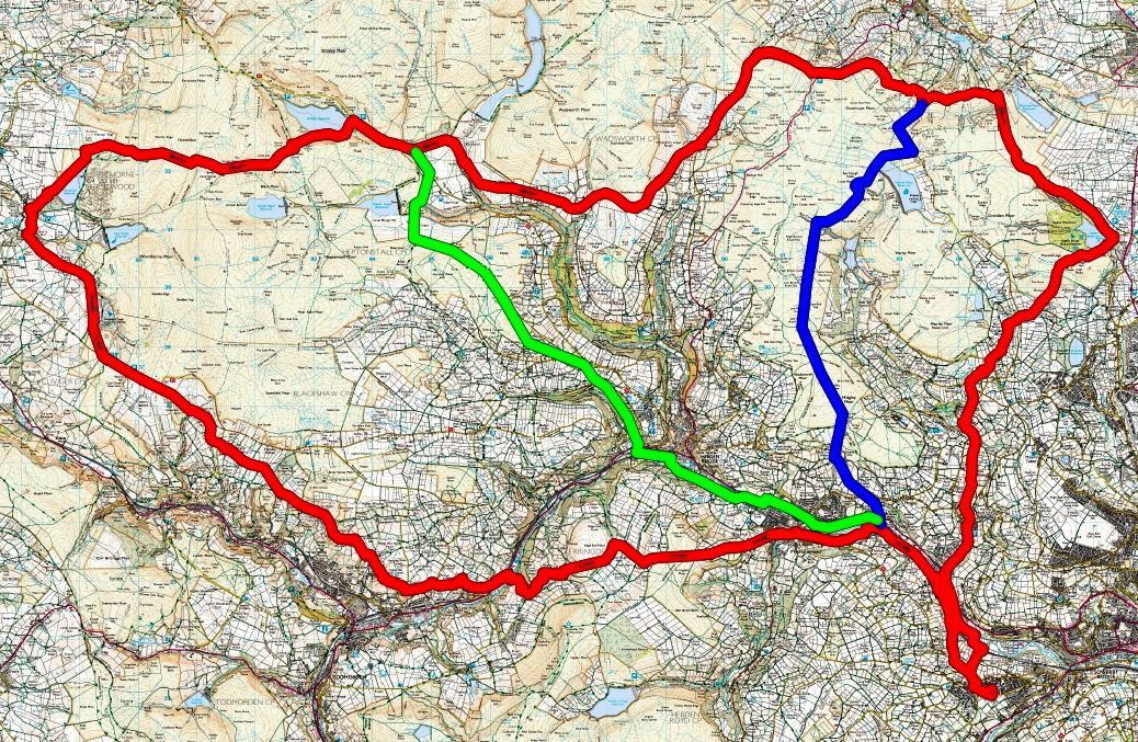
New routes for 2024
| Checkpoint | Grid Ref | Long Route | Medium Route | Short Route | |
| START | SE 045 231 | 0 | 0 | 0 | |
| Goitside | SE 041 275 | 3.5 | 3.5 | 3.5 | |
| Ogden | SE 066 309 | 6.6 | 6.6 | 6.6 | |
| Nab Water Lane | SE 033 331 | 9.5 | 9.5 | 9.5 | Short Route splits off |
| Grain Water Bridge | SD 995 324 | 12.9 | 12.9 | ||
| Clough Foot | SD 946 323 | 16.7 | 16.7 | Medium Route splits off | |
| Slack (Medium route only) | SD 973 287 | 20.2 | Chop Time 6.00pm | ||
| Hurstwood | SD 882 312 | 21.6 | |||
| Kebs Road | SD 903 283 | 24.2 | |||
| Stoodley Lane | SD 963 250 | 29.2 | Chop Time 6.00pm | ||
| Brearley | SE 027 258 | 33.9 | 24.5 | 15.6 | All routes combine |
| FINISH | SE 045 231 | 36.2 | 26.8 | 17.9 |
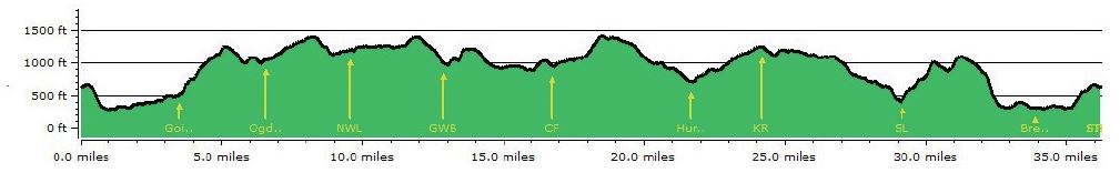
Route Profiles
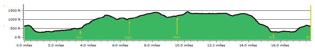
Short Route
Distance - 17.9 miles (28.8Km) Altitude gained/lost - 2676 feet (815m)
Medium Route
Distance - 26.9 miles (43.3Km) Altitude gained/lost - 3836 feet (1169m)
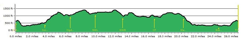
Long Route
Distance - 36.2 miles (58.3Km) Altitude gained/lost - 5515 feet (1681m)
Route Maps
As PDF files, please note that these are large files ~19MB, but they can be zoomed to 400% without loss of clarity.
2024 Short Route 2024 Medium Route 2024 Long Route
The route is available in Garmin GPX format. Please note that the GPS plot has been taken from rights of way plotted on a computer map, and may not always agree with paths on the ground. If you right click your mouse and choose "Save as" to save them to your computer (Windows)
2024 Short Route GPX 2024 Medium Route GPX 2024 Long Route GPX